FERP Data, Resources, and Protocols
Tree census data
The full set of data from the first three censuses of the UCSC FERP is available on Data Dryad (https:// doi.org/10.5061/dryad.6q573n64s). Additionally, the data are available on the ForestGEO web site at https://forestgeo.si.edu/explore-data/uc-santa-cruz-termsconditionsrequest-forms.
For even more direct access, see FERP_publicR.
Data users are strongly encouraged to consult with the Principal Investigator who collected these data for further information. Also, when appropriate, Data Users should consider including the Principal Investigator as a collaborator and/or co-author in the use of these data. The Principal Investigator can be reached at ggilbert@ucsc.edu.
Data from 2007 initial census of original 6-ha plot.
These are the data used in Gilbert et al. 2010.
FERP07data (right-/control-click to download)
These 2007 data are also curated on the CTFS ForestGEO server.
The complete data from the 2012 recensus, 2015 expansion to 16-ha FERP, and the 2017 recensus will be available soon.
Download assorted useful FERP resources here.
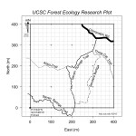
 Trail map of the UCSC FERP Trail map of the UCSC FERP |
 Trail map with litter traps Trail map with litter trapsand herp boards on the FERP |
|
|

UCSC Campus Natural Reserve |
 FERP Litter trap and |
FERP Protocols and training materials


